In Edomex, Institutional Style Atizapán Administration Implements Cutting-Edge Geophysical Infrastructure to Expedite Land Regularization / @Pedro_RVillegas @GobAtizapan
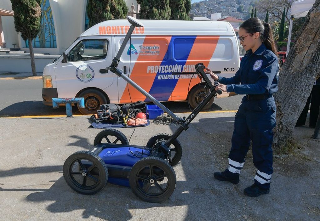
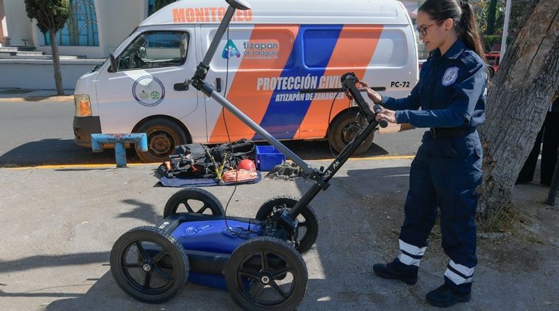
#SmartGovernance2026 #GeophysicalSafety —– #AtizapánDeZaragoza, #EstadoDeMéxico.- The Municipal Government of Atizapán de Zaragoza has achieved a historic milestone in civil protection by acquiring an advanced technological suite designed to map the subterranean landscape with surgical precision. Utilizing a high-resolution georradar and an audio-magnetotelluric system, the administration is now equipped to identify hidden geological vulnerabilities before they compromise the safety of the citizenry. This initiative, championed by Mayor #PedroRodríguezVillegas, represents a sophisticated paradigm shift from reactive emergency response to proactive scientific prevention. By visualizing the hidden depths of the urban subsoil, the city secures a more stable future for its growing population. This strategic investment is a testament to a leadership that prioritizes the inviolability of human life and the preservation of communal infrastructure.
During the formal commissioning of the new equipment, Mayor Pedro Rodríguez Villegas observed that «this technology is unparalleled in the State of Mexico,» effectively positioning the municipality as a regional leader in disaster mitigation. The diagnostic capabilities of the resistivimeter will allow engineers to detect subterranean cavities and verify the integrity of hydraulic networks, preventing costly collapses and sinkholes. Accompanied by the Coordinator of Civil Protection, Héctor Elorriaga Mejía, the Mayor emphasized that such erudition in urban planning is essential for a modern city. The data gathered will provide a transparent and comprehensive overview of the risks associated with the local topography.
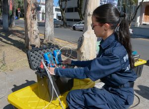
The first phase of this geological offensive will focus on the neighborhoods of Tierra de En Medio and Ex Hacienda el Pedregal, directly impacting the lives of over 1,468 families. For many of these residents, the presence of unidentified grutas or caverns has been a historical obstacle to obtaining legal titles for their homes. Through the scientific validation of the soil, the administration will finally be able to facilitate the regularization of these territories with absolute legal certainty. This measure is a benevolent intervention that replaces administrative uncertainty with the physical and legal security that every family deserves.
Ultimately, the modernization of the Atizapán Risk Atlas serves as the definitive cornerstone for an era of orderly and sustainable urban expansion. The integration of these geophysical tools ensures that the path toward legalizing property deeds is both swift and scientifically sound for the vulnerable sectors of the community. «The best way to predict the future is to create it,» noted Abraham Lincoln. By embracing this spirit of foresight, the current administration ensures that the patrimony of the atizapenses is built upon a foundation of truth and safety.
#miangelzorro
#MéxicoNewsTv – México News tv